Category: Mountain

A peak accomplishment
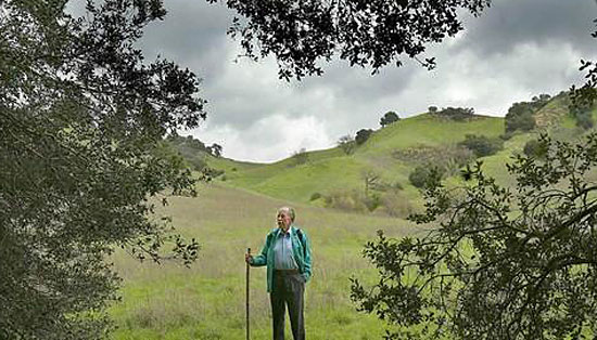
Milt McAuley’s love of the Santa Monica Mountains may be returned with a peak named in his honor.

Milt McAuley’s fingerprints are all over the Santa Monica Mountains. Soon, his name could be on one of the range’s most visible peaks.

Acting on a motion by Supervisor Zev Yaroslavsky, the Los Angeles County Board of Supervisors voted Tuesday to write the United States Board of Geographic Names in support of changing the name of Peak 2049 to “McAuley Peak.”

The motion is the latest boost to a campaign championed during the past several years by West Hills resident and avid hiker Coby King, who had long felt a special connection to McAuley. Before venturing onto a new trail, King would turn to McAuley’s landmark guidebook, Hiking Trails of the Santa Monica Mountains.

“Most hiking guides are really straightforward,” King said. “But his guidebook, you could hear his voice coming through in every hiking description. You could tell that the guy had a personality and that he loved the mountains.”
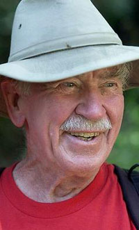
McAuley led group hikes into his 80s.

McAuley also authored and self-published other reference materials on the mountains, including a wildflower guide and a guide to the popular Backbone Trail, which transects the range from East to West and which he helped plot. McAuley’s books and advocacy for public acquisition of land in the Santa Monica Mountains drew scores of people to the area and generated a groundswell of support to protect the mountains from development.

Although King never met the conservationist, he said he did hike “just about every peak” in McAuley’s book. When the author died in 2008, King was moved to action.

“I felt like he deserved some kind of recognition for all that he had committed to the mountains,” King said. Out of all the hikes to peaks in his guidebook, “2049 was the only one that didn’t already have a name.”

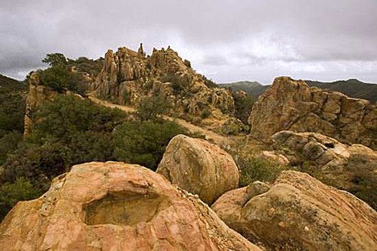
The peak is situated right next to the Backbone Trail and is crested by a large sandstone rock visible for miles. King said the peak is an appropriate monument to a man whose work still looms over the mountains. Since applications to name geographic landmarks can’t be filed until five years after the person’s death, King, who serves as chairman of the Valley Industry & Commerce Association, used his government expertise to start building a case.

After securing the blessing of the McAuley family, he garnered support from elected officials and worked with environmental groups like the Sierra Club, which began calling the site McAuley Peak in their materials.

King is hopeful that the U.S. Board of Geographic Names will quickly approve the application so that the new designation will become official sometime next year. And that’s good news to the many friends and former associates of McAuley, who believe his contributions warrant the honor.

Jim Hasenauer met McAuley in the 1980s when he and some fellow mountain bikers were trying to convince local trail managers to allow them to use the trails. Some of the hikers were resistant, but McAuley—whom Hasenauer described as a gentle giant—was welcoming.

“He felt that people needed to experience the trails, sights, vistas, flora and fauna of the area and then we would appreciate it and die protecting it,” Hasenauer said, adding: “To go on a hike with him was like going to a graduate seminar in mountain ecology.”

Ruth Gerson, who worked with McAuley on the Santa Monica Mountains Trails Council and serves as the organization’s current president, said he was instrumental in naming trails and opening them up for public use. “He was a wealth of knowledge in the mountains,” Gerson said. “There was nobody that disliked him. And he could out-walk anybody—even in his late 70s.”

Bill McAuley, Milt’s son, said he’s never hiked the peak that could soon be named in his dad’s honor. But he certainly intends to hit the trail when, hopefully, McAuley Peak becomes a reality.

“I see the names in the Sierras and they’re all people who had something to do with the mountains,” Bill said. “He really did have a lot of influence.”
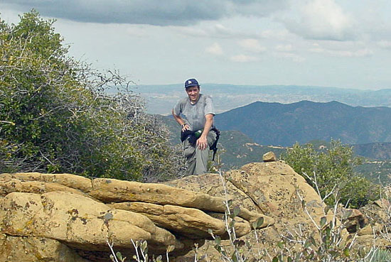
Hiker Coby King led the campaign to have Peak 2049 named after McAuley.

Posted 9/11/14

A high note for mountain protections

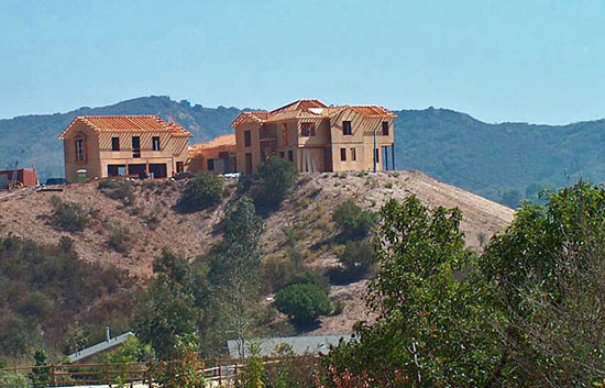
Ridgeline developments like this will be banned in the Santa Monica Mountains by the county’s new rules.

In a vote that will resonate for generations, the California Coastal Commission this week cleared the way for the enactment of a wide-ranging plan to protect the Santa Monica Mountains from development that already has scarred portions of one of the region’s most important environmental and recreational resources.

The 12-member commission voted unanimously in favor of a land use plan adopted last month by the Los Angeles County Board of Supervisors, despite strong opposition from real estate development interests. The Coastal Commission vote was mandated by state law and represents a milestone in the years-long effort to preserve the mountains along the coast as a rural escape for tens of thousands of visitors each year.

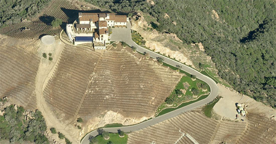
The plan will, among many other things, ban ridgeline development, save oaks and other native woodlands, outlaw poisons that can harm wildlife, protect water sources, restrict lighting to preserve the night sky and prevent the opening of new vineyards, which take a toll on the land and water.

“This is a stunning achievement, to get a unanimous vote on a plan that has been on-again, off-again for three decades,” said one of its strongest advocates, Supervisor Zev Yaroslavsky, whose district includes the Santa Monica Mountains. “It’s a tribute to all the stakeholders—environmentalists, equestrians, homeowners, agricultural interests, among others—who came together to find common ground.”

During testimony before the Coastal Commission on Thursday, Yaroslavsky said he had spent two decades on the Board of Supervisors “fighting against ill-conceived developments that have desecrated” the mountains. He told the commission that it now had a “historic opportunity” to stem the damage, an opportunity the commissioners seized.

They left virtually untouched the county’s proposed plan, which was crafted by Yaroslavsky’s office and the Department of Regional Planning. The only substantive addition was a clause that expressly affirmed the right of residents to grow organic gardens through ecologically sound farming methods—a move considered necessary because of misinformation that had been spread about the plan in the days leading up to the commission’s vote.

Much of Thursday’s day-long hearing in Santa Barbara was consumed with people testifying in support of the county’s plan. But one woman used her time to blast the 11th-hour falsehoods aimed at derailing the plan by claiming, among other things, that food gardens would be banned.

“It’s just not fair to those of us who aren’t experts to be given emails that say you’re not going to be able to grow your own food,” said Janet Friesen of the Natural Resources Defense Council. “I’m here to say that I don’t think it’s right when there are paid lobbyists who are misleading people.”

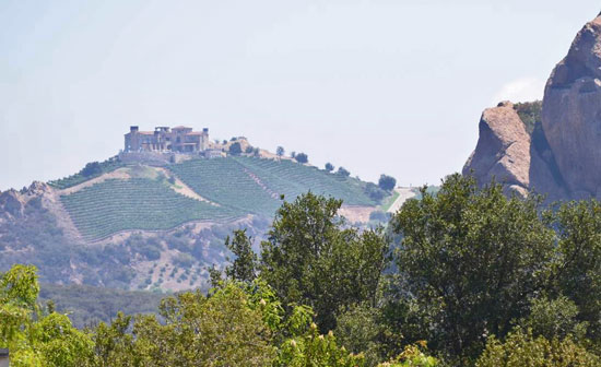
Leading the campaign against the county’s plan, called a Local Coastal Program, was Don Schmitz, a consultant and lobbyist who also owns a vineyard in the Santa Monica Mountains. Under the plan, existing vineyards can remain in business, although no new ones would be allowed to open—a restriction that Schmitz criticized during his testimony on Thursday.

He disputed the negative environmental impacts of vineyards, calling the businesses a “significant draw to the Santa Monica Mountains National Recreation Area.”

“Not everybody is able or even wants to throw on a backpack and do 10 miles on the Backbone Trail,” Schmitz said of one of area’s tougher hikes.

Now that the Coastal Commission has endorsed the plan’s policy direction, it will take another vote in the months ahead on the details of its implementation. The matter will then move back to the Board of Supervisors for a final vote.

Under the plan, existing vineyards can stay, while new ones will be prohibited.

Mansion “driveways,” such as this winding one off Malibu Canyon Road, will be closely reviewed.

The mountains will be protected for future generations from development that scars the environment.

Posted 4/11/14

A milestone gift for L.A.’s trails

The Backbone Trail is one of 7 projects benefiting from an infusion of grant funds. Photo/National Park Service

The Backbone Trail is one celebrity-owned property and an easement short of completion. The Cold Creek High Trail is just three parcels shy of being in public hands. Just one 700-foot path and hikers and horseback riders on the Las Virgenes Creek Trail will no longer have to pull up short at the Ventura Freeway.

But those gaps and more may soon be bridged with the help of some $3.2 million in county grants.

Generated by the county’s 1996 Proposition A park bond, and approved by the Board of Supervisors on Tuesday, the grants promise to make a big difference for nature enthusiasts in the Santa Monica Mountains, where some of Southern California’s best-known and most beloved trails are tantalizingly close to full public ownership.

Although the mountains have long been regarded as a public treasure, their property lines are actually a public-private patchwork, and many trails, habitats and watersheds run through private backyards and no-trespassing areas. Environmental advocates have worked for decades to acquire key lots and easements, and to forge connections among the trails that crisscross the peaks and canyons.

This week’s grants, spread among seven projects and ranging from $59,438 to $500,000, come from a pot that is periodically disbursed to fund parkland and open spaces, but this round is expected to make an especially big impact.

One $500,000 grant, for example, would get the ball rolling on a 110-acre addition to the Santa Monica Mountains National Recreation Area. The acreage, in Malibu’s Ramirez Canyon, “is a critical element . . . in filling a major gap in public ownership in the Santa Monica Mountains,” says Sam Hodder, who directs the Trust for Public Land in California. Among other things, Hodder says, the property includes a sensitive oak woodland habitat and a vulnerable stream that flows directly into Santa Monica Bay.

Another $500,000 grant, to the Mountains Restoration Trust, would complete the acquisition of the last three private parcels along the Cold Creek High Trail Project, adding 17.4 acres and 1.63 miles of trail between Stunt and Cold Canyon Roads. The extension will not only restore a longstanding neighborhood hiking and equestrian trail that was badly damaged in the fires and floods of the early 1990s, but—more importantly—will protect the Cold Creek watershed, a key habitat for mountain wildlife.

A third $500,000 chunk of change will go toward the Don Wallace Trail Project, a new path that will finally give hikers and equestrians safe passage down through the underpasses at the 101 Freeway and Agoura Road in Calabasas and on into Malibu Creek State Park.

And perhaps the most exciting grant, for $465,000, will allow the National Park Service to complete the Backbone Trail, one of the best known and most heavily used trails in Los Angeles County. For some 30 years, more than 35 organizations have been trying to obtain a public right-of-way across all of the 177 pieces of property that the trail crosses as it wends its way over the crest of the Santa Monica Mountains to the Pacific.

As of this year, only two parcels remained outstanding. A tentative agreement to convey an easement for one of them recently was reached with the National Park Service, according to Melanie Beck, who handles land deals for the NPS in the Santa Monica Mountains.

When the easement is finalized, it will leave just one incomplete spot on the 65-mile trail: a 40-acre swath of chaparral in Trancas Canyon owned by former Gov. Arnold Schwarzenegger and Betty Weider, the 77-year-old wife of Schwarzenegger’s longtime friend and business partner, the fitness magazine publisher Joe Weider.

A spokesman for the governor confirmed this week that Schwarzenegger and Weider were approached years ago about the acreage but no agreement was reached. Schwarzenegger, the spokesman added, “remains open to meeting and talking about it again.” Weider could not immediately be reached.

The grants represent a big moment in the long-running effort to create a network of public pathways through the mountains.

“We need to celebrate the years of hard work that have gone into building the trail system,” Beck said. “With these accomplishments, we can help share and publicize this trail system with the many groups that wish to enjoy the Santa Monica Mountains long into the future.”

Posted 9/20/12

A mountain welcome

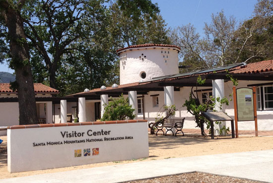
The Visitor Center is in the former stables of the King Gillette Ranch, near Calabasas.

Few wilderness areas are as easy to visit as the Santa Monica Mountains—or as challenging for the average visitor to understand.

Sprawled over 153,000 acres and stretched along 44 miles of coastline, the Santa Monica Mountains National Recreation Area is part federal, part state and part local. Its ownership is an alphabet soup of government agencies and nonprofits; its internal boundaries are a public-private jigsaw puzzle.

Just figuring out which trails permit dogs can be a project. Yet the closest thing it has had to a visitor’s center has been a far-off office in a Thousand Oaks municipal complex.

Now, after years of planning and study, the nation’s largest urban national park finally has built a true, central gateway where the public can stop for information about its trails, beaches, amenities and wildlife.

On June 9, the Anthony C. Beilenson Interagency Visitor Center will open to the public in the heart of the recreation area, on the grounds of the former King Gillette Ranch near Calabasas.

“This is fantastic,” said Lisa Soghor, deputy executive officer for the Mountains Recreation and Conservation Authority, which manages the ranch and co-hosted a press tour this week in advance of the grand opening.  “To have it here, at the heart of the mountains, in the center of the recreation area, is just really a dream come true.”

Los Angeles County Supervisor Zev Yaroslavsky agreed.

“The King Gillette property is one of the most beautiful in the Santa Monica Mountains,” said Yaroslavsky, whose 3rdDistrict includes the recreation area. “It’s centrally located in the national and state park, making it a great location for the Visitors Center. And it’s rightly named after former Congressman Anthony Beilenson, who had so much to do with the preservation of the Santa Monica Mountains.”

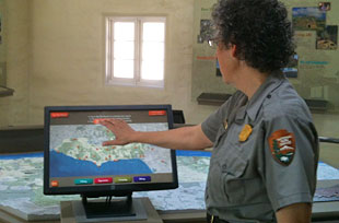
Park ranger demonstrates new interactive map.

The new center, near the intersection of Las Virgenes Road and the Old Mulholland Highway, will also reflect the colorful history of one of Southern California’s most storied ranches. The Spanish-style building, erected in 1928, is the former horse stable of a 588-acre estate developed by King Camp Gillette, the razor-blade baron, and designed by famed Los Angeles architect Wallace Neff.

After Gillette’s death, the ranch—which he described as “paradise on earth, California style”—had a cavalcade of quintessentially Californian owners. MGM director Clarence Brown, partied and filmed on it from 1935 until the 1950s. Then it was sold to the Claretian Order of the Catholic Church, which used it as a seminary until the mid-1970s.

As urban development encroached on the mountains, neighboring homeowners lobbied the state to buy and preserve it. But in 1978, the land was sold to the Church Universal and Triumphant, a New Age doomsday sect that renamed it “Camelot” and moved its headquarters into the verdant, mountain-ringed valley.

That incarnation lasted until the mid-1980s, when the church moved to a remote plot in Montana, where members began preparing for Armageddon. (“You have 10 million auras in Los Angelesand here you have wide open space,” the church leader, Elizabeth Clare Prophet, explained.)

In 1986, Soka University of America, a liberal arts college financed by a Japan-based lay Buddhist organization, bought the ranch and announced plans to build a campus. But by now, local homeowners and environmental groups were organized enough to block the development. The appeals and lawsuits lasted until 2005, when an unprecedented coalition of government agencies, including Los Angeles County, raised $34 million to buy the land and turn it into the recreation area’s gateway.

“As with many important parkland acquisitions, it took more years and more battles than we had anticipated—but it also consolidated the resolve of state, federal and local park agencies to make this happen,” said Joe Edmiston, executive director of the Santa Monica Mountains Conservancy.

Until now, the ranch has been mainly been known as the site of the reality TV show, “The Biggest Loser,” which leases the estate’s property. This week, however, the new Visitor Center stepped into the spotlight, with rooms full of colorful displays and exhibits and a top-of-the-line LEED Platinum certification for environmental sustainability.

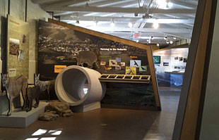
One of many wildlife displays at the center.

“We are proud to say that this is the first ‘net zero’ Visitor Center in the National Park System,” National Park Service Acting Superintendent Lorenza Fong noted, adding that the center will produce all of its own energy through a photovoltaic solar energy system. The historic building was remodeled and preserved with $9.5 million in federal stimulus grants.

Named for the congressman who introduced the 1978 legislation creating the recreation area, the center will be jointly staffed and managed by the recreation area’s major operators: the National Park Service, the California State Parks, MRCA and the Conservancy.

At the press tour, rangers proudly showed off the front desk made from recycled materials and a “virtual postcard” booth that allows visitors to photograph themselves against a background of the recreation area’s breathtaking scenery.

Most impressive, however, was an interactive display that cuts through the confusion over which rules apply in which sections of the recreation area’s vast network of parklands. It’s a useful tool, because, even on the trails around the Visitors Center, they change. Because the National Park Service allows dogs and the State Parks don’t, for instance, only the immediate grounds of the center allow pets on leashes; cross a bridge onto the parts of the recreation area owned by the state or MRCA, and dogs are forbidden.

“It’s still an issue,” laughed NPS Supervisory Park Ranger Barbara Applebaum, education supervisor for the center. But with a touch of the screen, she was able to highlight a host of places within the recreation area that were perfect for every variety of visitor—families, bicyclists, wildflower enthusiasts, serious hikers, swimmers and even canines.

The Visitor Center is at 26876 Mulholland Highway, Calabasas, and free to the public. The Grand Opening, with food trucks, live music and activities for all ages, will be June 9 from 10 a.m. to 4 p.m.  For more information, call 805-370-2301 or visit www.nps.gov/samo. For directions and a flier, click here.

YouTube Preview Image

Posted 5/31/12

Deadly passage for a mountain lion

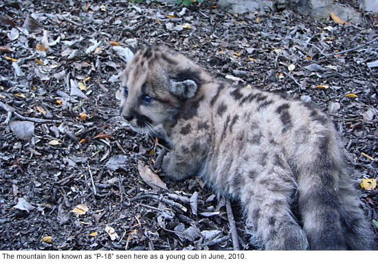
He was little more than a teenager, strong and healthy, big for his age and not yet fully grown. What he was doing at night near the freeway is uncertain; those who knew him believe that like, most late adolescents, he was just looking for some turf that hadn’t already been claimed by others, just trying to strike out on his own.

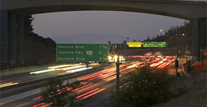
 In any case, the 15-month-old mountain lion known to the National Park Service as P-18 (the “P” stood for “Puma”) somehow wandered onto the 405 Freeway just south of the Getty Center southbound onramp shortly after 4 a.m. Tuesday. His death was a hit-and-run.

 “He was found at 7:30 am when traffic started backing up and the CHP went in and found a dead lion with a GPS collar,” says a stricken Christie Brigham, chief of planning, science and resource management for the Santa Monica National Recreation Area. Born last May in the Santa Monica Mountains and part of a decade-long national study, the lion’s movements had been tracked since he was three weeks old.

A total of 21 mountain lions have been tracked since 2002 in the area, says Woody Smeck, park superintendent in the Santa Monica Mountains National Recreation Area.  Of those, Smeck says, only one is known to have successfully crossed a freeway. A lion known as P-12 crossed Highway 101 in 2009 into the Santa Monica Mountains near Liberty Canyon. He survived to father the cub who died this week.

Southern California’s freeways may not invite their denizens to think much about nature, but wildlife crossings are a significant transportation issue in L.A.  Great swaths of natural habitat here are bisected by asphalt, which may impede the movement of coyotes, mountain lions, bobcats, raccoons and other native species but doesn’t stop their instinct to travel in search of food and mates.

Wild animals require safe access to new territory so they don’t inbreed and endanger their species’ survival. Male mountain lions in particular tend to range widely, says Brigham, and previous tracking has shown them to range throughout the entirety of the Santa Monica Mountains, from Camarillo to the 405 Freeway.

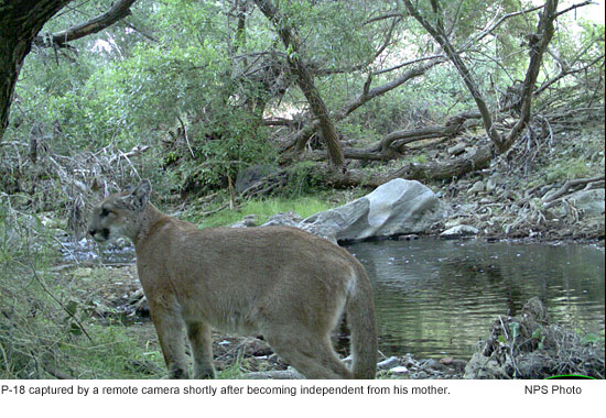
P-18, she says, was one of four lions being tracked this summer; he had appeared to be slowly making his way east from his mother’s home range in Malibu Creek State Park. Radio telemetry signals from his collar placed him near the Getty Center around 4 a.m. just south of an onramp

“We suspect there was another, untagged, male lion using that part of the moutain, which meant it wasn’t an open territory for him as a young male,” says Brigham. “We think he was trying to disperse out of the Santa Monicas in search of open space when he was hit.”

Brigham says the area where P-18 died has been especially lethal to wildlife. “We found an un-collared, road-killed lion in the same area in 2008, “ she says.

Moreover, she says, P-18’s life might have been spared had he padded a mile or so further north to the Sepulveda Boulevard undercrossing. Motion-sensitive cameras, which have been set up there to track wildlife, have shown that, while it is not the ideal wildlife crossing—it was built for 4-wheeled vehicles, not 4-legged creatures—and rarely used by mountain lions, it is heavily used by other wildlife with relative safety.

Unbroken fencing might have funneled the lion to a safe passage, says Brigham. “But there was nothing to direct him to that area.”

Wildlife issues have been under discussion with Caltrans and other agencies as part of the 405 freeway widening project, says Brigham, but money has been tight and fencing proposals have run up against right-of-way and setback issues.

“There are rules about how far the fence has to be from the roadway,” she points out, “and not all of the land involved is Caltrans right-of-way.”

Plans for improved lighting and wildlife access are in the works in a few spots including the Skirball Center Drive bridge area and the Bel Air Crest Road undercrossing, “but the ultimate solution is to put in wildlife crossings that will be effective and funnel animals to the appropriate place.”

The 405 isn’t the only freeway with a wildlife problem; Highways 101 and 118 also bisect important habitat. Nor is the issue just one of road-kill—a wild animal trapped on a freeway is lethal to motorists, too.

Caltrans has applied for a $10 million federal grant to build a wildlife tunnel in Agoura Hills under the 101 at Liberty Canyon Road, says Francis Appiah, an associate environmental planner and natural scientist at the state agency. But the grant has yet to be approved.

“Investing in connected pieces of parkland and constructing wildlife crossings along major freeways around Los Angeles is essential for long term mountain lion survival in the Santa Monica Mountains,” says park superintendent Smeck.

Follow Zev

More News

The 405 Report

405 speeds little changed

Afternoon rush hour speeds haven’t changed much but the worst traffic may be ending sooner. Afternoon rush hour speeds on the… 

Need To Know

Information Online

Our list of useful government links.

Information Online

Our list of useful government links.

Information Online

Our list of useful government links.

Information Online

Our list of useful government links.

Information Online

Our list of useful government links.