


Top Story: Transportation
Bike plan heads toward finish line
January 12, 2012
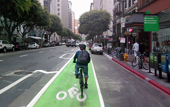
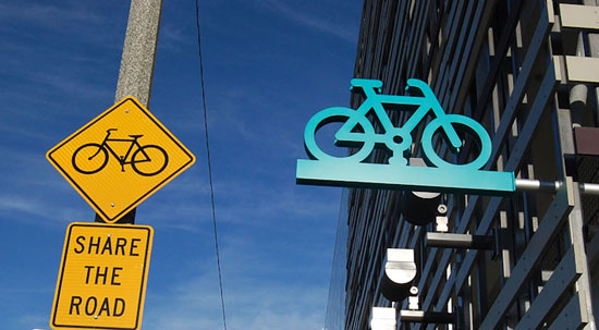
Painted bike lanes, like this one downtown, could be coming to county streets. Eco-Village blog photo
A revised bicycle master plan, infused with some new and creative elements, is on its way to the Board of Supervisors following approval Wednesday by the county’s Regional Planning commission.
The bike plan represents the county’s first such effort since 1975. Prompted by supervisors and members of the cycling community, who urged planners to move into the vanguard of bike innovation, the current version of the plan includes a number of up-to-the-minute design elements that could be placed on streets in unincorporated parts of the county. Those include colored bicycle lanes, “cycle tracks” and buffered lanes in which bikes are separated from automobile traffic, and “bicycle boxes” that designate a place for cyclists to move ahead of cars at some intersections.
“While these treatments do not have approved design standards at this time, the County will incorporate them into the Plan’s toolbox of treatments as their uniform designs and standards are approved by the State of California Department of Transportation,” according to an executive summary of the plan approved Wednesday. “The County promotes the use of these innovative treatments and will apply for and implement experimental projects utilizing them where cost effective and where such projects enhance the safety of bicycles, pedestrians, and motorists.”
The latest version of the plan also increases the size of the network of new bikeways proposed for unincorporated part of Los Angeles County over the next two decades, from 816 miles to 832 miles. Creating the network will cost an estimated $331 million. The plan calls for nearly 72 miles of dedicated bike routes and nearly 274 miles of bike lanes, as well as 22.8 miles of slower moving, cycling-friendly “bicycle boulevards” on local or residential streets. However, most of the network would be devoted to some 463 miles’ worth of “Class III” bike routes, with signage but no dedicated space for cyclists.
The Board of Supervisors is expected to invite more public comment before it takes action on the bicycle plan in coming weeks.
“Generally speaking, we feel there’s been quite a bit of improvement,” said Alexis Lantz, planning and policy director for the Los Angeles County Bicycle Coalition. She said her group will continue to advocate for the plan to function as a “living document” that will contribute to more and better cycling in the county over the next 20 years. That means streamlining the process for engineers in the future to upgrade bike facilities when the opportunity arises to do so, she said.
Posted 1/11/12
This is how we rolled
November 17, 2011
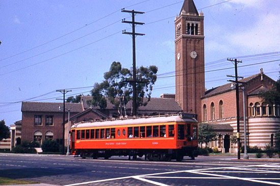
The Expo Line will pass USC just as the Red Cars did back in '53. Photo: Alan Weeks/Metro Archives
Remember the Santa Monica Air Line? How about the Los Angeles & Independence?
Probably not.
But the two historic railways will be there—and not just in spirit—when the Expo Light Rail Line begins rolling from Downtown westward in just a few months, with its first terminus at La Cienega Boulevard.
Although the Westside’s first mass rail project in 50 years feels in some ways like the dawn of an era, Los Angeles has been down this road before. In fact, it has been down the same set of train tracks: The Expo Line will run on a historic railroad right-of-way that has carried Southern Californians, off and on, for more than 135 years now, first behind steam engines and then in iconic Red Cars.
“We’re definitely going back to the future,” jokes John Smatlak, a rail transit consultant and volunteer rail historian at the Orange Empire Railway Museum in Perris. “Of course, it looked a lot different back then than it does today.”
“This was a route that started out in 1875 as a steam railroad built by a silver baron,” confirms Matthew Barrett, research librarian for the Metropolitan Transportation Authority, “and then later became part of the Pacific Electric Red Car line.”
Indeed, Barrett says, some images of the Air Line from the Metro archive are being embedded as station tiles along the Expo Line as reminder of the connection. (See gallery below.)
Constructed by John P. Jones, a U.S. senator who had made a fortune in Nevada, the Expo Line route was originally the Los Angeles & Independence Railroad, the linchpin of a grand plan. Jones owned a silver mine in Inyo County and coastal ranch land where Santa Monica now stands. He wanted to connect the two with Los Angeles and persuade the city to situate its port near his slice of the shoreline.
However, his powerful rival, Southern Pacific Railroad, wanted the port to be near its lines in San Pedro, and Jones had lost bargaining power; his silver mine was exhausted. “Jones built the link from Downtown to Santa Monica, and then he went bankrupt,” says Barrett, the Metro research librarian.
In 1877, Southern Pacific bought Jones’ struggling railroad and turned it into a local freight and passenger hauler. Its cars would steam from an ornate Victorian depot Downtown to a long wharf built out into the ocean, carrying tourists and cargo through the then-sparsely populated fields and plains that would become L.A.’s Westside.
Eventually, Southern Pacific leased the line to a subsidiary run by Henry E. Huntington, the real estate tycoon nephew of the president of the railroad. Huntington electrified it and added it to the rail system he was building to less developed land holdings outside L.A.’s city limits.
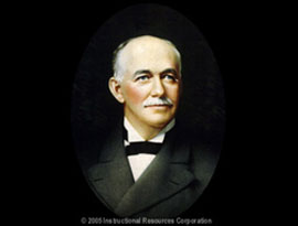
Henry E. Huntington
Painted a bright, marketable red, Huntington’s electric cars ran between Downtown L.A. and increasingly far-flung suburbs, including Santa Monica. By 1908, the old Los Angeles & Independence rails were bustling with the so-called Red Cars and the line, which also carried a lot of freight, had been renamed “The Air Line,” a common term back then for the shortest distance between two points. In 1911, when a number of railroads merged in Southern California, it officially became part of the Pacific Electric railway.
At the peak of their popularity in the Roaring Twenties, the Red Cars covered some 1,100 miles of railway from the San Gabriel Mountains to San Bernardino to the beaches of Orange County. They became an essential part of Los Angeles’ culture and lore.
The Red Cars showed up in movies. They were written into waltzes. The depots became famous in their own right. Whole communities sprang up as so-called “streetcar suburbs.”
In his history of growth in Los Angeles, “The Reluctant Metropolis”, William Fulton wrote that Huntington “built a $60 million fortune around the Pacific Electric in little more than a decade.” But, he added, Huntington saw the Red Cars mostly as a tool for real estate speculation and disregarded the fact that, with so many lines going through L.A., “it would often take a PE [Pacific Electric] Red Car longer to leave the downtown area than to make the entire run to Pasadena or Santa Monica.”
Still, says Barrett, the Red Cars mapped the urban footprint of Southern California more than any other early influence, including the automobile. “Many assume that the freeways created our sprawl,” he says, “but it was the railways built many years earlier that laid the foundation for it.”
Eventually, Barrett and other historians say, a combination of factors caused highways and cars to displace the Red Cars. And no, they say, it wasn’t just the kind of auto and tire industry maneuvering dramatized in “Who Framed Roger Rabbit?” (“That was the Yellow Cars, not the Red Cars,” says Barrett. “That movie has done more to create incorrect local history than anything I can think of.”)
Angelenos were also the earliest auto adapters outside Detroit. Voters distrusted the railroads. Real estate speculators realized they didn’t necessarily need to invest along rail lines. By the late 1930s, the Automobile Club of Southern California was calling for “a network of traffic routes for the exclusive use of motor vehicles”—i.e., freeways—while rail advocates were struggling to build a consensus. When gas rationing during World War II ratcheted up demand for rail, it revived profits but underscored the need for investment in rail infrastructure.
“People always omit the context of the time,” says Smatlak of the Orange Empire Railway Museum—a resting place for most of what’s left of Southern California’s stock of retired Red Cars. “Yes, there were tire and rubber and gas and oil companies involved in shifting transit to buses. But by the 1950s, the rail system was really worn out and they were faced with making a massive capital investment.”
Adds Barrett: “If we have anyone to blame, it’s ourselves—or our grandparents—for not being on the steps of City Hall, demanding our electric railway system be preserved in 1943 after the first smog alert was generated.”
The Air Line stopped carrying passengers in 1953. Eight years later, the last Red Car rumbled into retirement. And, with the exception of a decade or two, Angelenos have been waiting for relief ever since, stewing in their cars.


Need bike parking? No sweat
November 16, 2011
Santa Monica's new Bike Center is a sign of the times, offering new resources to folks who cycle to work or play.
Portland may get all the bicycle buzz, but Southern California cyclists can lay claim to some bragging rights, too, as Santa Monica on Friday opens what’s billed as the largest bike parking facility in the country.
The Santa Monica Bike Center will provide cyclists with secure bike storage, rentals, repairs and more. The ribbon cutting ceremony will take place Friday, November 18, at 10 a.m., and will be followed by open houses from 11 a.m. to 5 p.m. on Friday, Saturday and Sunday.
Up to 260 regular customers can reserve personal locking stations and showers for $15 monthly or $99 annually. Lockers and towels will be available at additional cost. (See the website for full membership details, including 24/7 access to the secure bike parking area.)
For all users and visitors, the center will provide other services like bike and Segway rentals, retail supplies, self-service air and repair station, and a “bike valet”—just drop off your wheels and they will be safely stored under supervision.
The center will also be used for special events, cycling classes and bike tours, all part of a plan to show people the upside of choosing transportation that is greener, healthier and, in many cases, just as fast as driving.
“InSanta Monica, a bike is really time-competitive with a car for most trips,” said Lucy Dyke, deputy director for special projects for the City ofSanta Monica. “Our streets are very congested.”
Josh Squire, CEO of Bike & Park, which operates the Santa Monica Bike Centerand others like it nationwide, said it is the highest-capacity bike parking facility in the country.
The bike center is located at Colorado and 2nd Street—next to the future site of the Expo Line’s westernmost station. The light rail line eventually will connect downtown L.A. to Santa Monica. Phase 1 is nearing completion, and an initial segment—from downtown to La Cienega/Jefferson—is expected to open early next year. (Check out this guided video sneak preview with Supervisor Zev Yaroslavsky.) Phase 2, which broke ground in September, will extend the line from Culver City to Santa Monica.
The Los Angeles County Metropolitan Transportation Authority partnered withSanta Monica in 2007 to create the $2 million dollar bicycle transit hub. Metro funded $1.5 million and Santa Monica pitched in the remaining $500,000.
Posted 11/16/11
Catching an early bird Expo Line ride
November 6, 2011
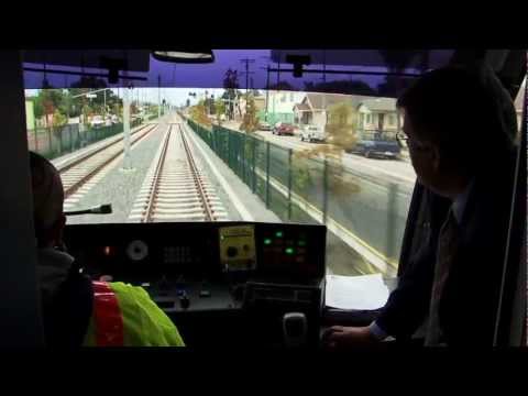
This is only a test—but not for long. As the Exposition Light Rail Line rolls closer to becoming a reality for Los Angeles transit customers, operators are now trying out the trains daily on portions of the new route. (Details on the test runs—from Flower and 23rd Street to La Cienega and Jefferson Boulevard—are here, along with safety tips.)
Supervisor and Metro Board Member Zev Yaroslavsky recently hopped aboard one of the test runs. The view from the train made it clear, he said, that getting from Point A to Point B will be only part of the Expo Line’s journey. As new routes connect with existing lines, entire regions of Los Angeles County are becoming accessible via public transit.
“Every one of these lines is another tipping point,” Yaroslavsky said.
All the test runs are a prelude to opening the first leg of the line early next year. Initially, trains are expected to run from the 7th Street Metro Center downtown to La Cienega and Jefferson. Meanwhile, construction is continuing on Phase 1’s westernmost station in Culver City.
This interactive map provides a preview of some of the cultural attractions, employment centers and educational institutions along Phase 1 of the route—including USC, the Natural History Museum, the California Science Center, the California African-American Museum and the Los Angeles Memorial Coliseum.
Eventually, Expo Phase 2 will extend all the way to 4th Street and Colorado Avenue in Santa Monica. Ground was broken on that phase a couple months ago. When complete, the 15.2-mile line will be the first mass transit rail project on the Westside since the Red Cars.
Posted 11/6/11
Experts onboard with Westside Subway
October 19, 2011
 A key stretch of the Westside Subway could safely be built under the Beverly Hills High School campus, a high-profile panel of experts told a Metro committee Wednesday after reviewing the results of extensive testing for earthquake hazards, vibration and noise, subterranean methane gas and abandoned oil wells.
On all counts, the experts said, subway tunneling under the school could be accomplished without endangering students or others, without undermining the school’s role as an emergency evacuation center and without interfering with plans to one day remodel the campus to include an underground parking garage or other buildings.
Significantly, the experts also concluded that it would be dangerous to build the Century City subway station on Santa Monica Boulevard, one of two locations under consideration, because of the presence of two active earthquake faults, one running parallel to Santa Monica Boulevard. The other potential Century City station site—at Constellation Boulevard and Avenue of the Stars—is not on an active fault and thus remains a viable option for a station, the experts said.
The experts’ testimony before the Metro board’s Planning and Programming Committee could play a pivotal role in the subway’s planning. While the committee members took no positions Wednesday on what they heard during the briefing, the question of where to place the Century City station has been a matter of heated debate, with many in Beverly Hills vigorously opposing the Constellation station because the route to get there would pass under their city’s high school campus.
Those testifying included not just experts from project’s tunneling advisory panel but also members of a specially-convened group of prominent independent reviewers brought in to assess the soundness of the research.
One of the independent experts, seismologist Lucy Jones of the U.S. Geological Survey and Caltech, said her group “completely agreed with” the conclusion that “the Santa Monica Boulevard station sites would be dangerous to build on.”
At the same time, she emphasized that it is possible to safely to build tunnels through earthquake zones by having the tunnels cross the faults at a sharply perpendicular angle. That would be the case in the route involving the Constellation station.
“To build a subway in Los Angeles, you can’t avoid earthquakes,” Jones said. “They’re going to be here. And you cannot avoid faults. You can, however, build effectively around faults and it’s been done in a lot of locations: in Los Angeles, in San Francisco, Mexico City…What you’ve got to try to do is to put your tunnels at a high angle, close to perpendicular to the faults, and avoid ever putting a station in a fault.”
Also testifying was consulting earthquake geologist James Dolan, a professor of earth sciences at USC who is among the project’s fault experts. (For a full list of the experts, click here; their full reports are now posted here, along with a letter on their findings.)
Supervisor Zev Yaroslavsky, a member of the Metro committee, said bringing in an independent expert peer review panel made up of “people that the public knows and recognizes” was important and, “given the rhetoric that’s been freely flowing out of Beverly Hills,” could help alleviate concerns about the impartiality of the scientific research.
And he stressed the significance of what’s at stake.
“This has to be a decision, when we make it, that has to be based on science and facts, not based on what we feel or think based on our gut,” Yaroslavsky said. “This is a very expensive decision that we’re going to make. It’s a profound decision both in terms of planning and in terms of finances. If we build a station in the wrong place and three months after we build the station we have an earthquake and the station is destroyed and people are killed, we have an issue.”
Beverly Hills Mayor Barry Brucker attended the committee meeting and said afterward that he found the presentation impressive. Still, he said it is important to have the city’s own experts review the scientific reports, particularly when it comes to the finding of no active faults at the Constellation Boulevard site.
“I’m not skeptical of the science but we are going to have our consultants get all that data,” Brucker said. “It’s just good prudent governance to have a second independent peer review that we commission.”
In a statement, Beverly Hills Unified School District president Lisa Korbatov said Metro had opened a “veritable Pandora’s box” with the seismic data presentation, and said the agency had held on to the data for too long without sharing it with the public.
Metro CEO Art Leahy responded with his own statement Thursday morning, saying that key information was made public soon after it was first analyzed. “Within just the past few months,” Leahy said, “our technical experts have located precisely long-suspected fault features. Their work was reviewed and confirmed yesterday by independent reviewers I engaged six weeks ago.”
Supervisor Michael D. Antonovich, also a member of the Metro committee, asked during the meeting how much the experts were being paid. Metro officials said they were unable to immediately provide the figure but said it was part of the project’s overall budget. After the meeting, Jones said that, as a U.S. government employee, she was not being compensated for her work but was doing it as part of her job.
The Metro board last year approved the subway project’s draft environmental impact statement/report, with a proposed route that included the two possible locations for the subway’s Century City station.
At the same time, the board approved a motion by Yaroslavsky calling for a thorough review of all the potential risks around the high school and throughout West Beverly Hills, Century City and Westwood.
Wednesday’s oral report to the board committee represents the first public accounting of what the experts found. Their assessment will be included in the project’s final environmental impact statement/report, expected to be released this winter.
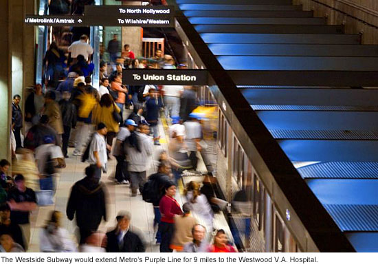
After a final round of public comments, Metro’s board is expected to vote on the project early next year. As currently envisioned, the Westside Subway would be a 9-mile extension of Metro’s Purple Line, with seven new stations ending at the Westwood V.A. Hospital.
Some construction could begin as early as 2013. If completed by 2022, the project could cost an estimated $5.3 billion. Funding will come in part from Measure R, the ½-cent sales tax approved by county voters in 2008, but federal money will also be required.
Here, based on testimony and executive summaries posted Wednesday, are some of the experts’ conclusions:
There is “no reasonable tunnel alignment” that could avoid passing under any structures on the Beverly Hills High School campus. (A presentation during the meeting showed that the tunnel would only run under Building B of the high school’s south wing, not the gym/pool building.) The depth of the tunnel—55 to 70 feet below the surface—would allow space for a future structure such as an underground parking lot to be built above it, the summary said.
Vibration from subway trains traveling under the campus would be 64 decibels or less—below the federal threshold of 72 to 75 decibels. The noise level would be no greater than 33 decibels, less than the federal standard of 35-40 decibels.
Advances in tunneling—notably through the use of pressurized closed-face tunnel boring machines—will minimize the risk of ground settlement during the project and were successfully used in building the Metro Gold Line’s Eastside Extension, the summary said.
Tunnels would be built to “maximum design earthquake” standards using the closed-face tunnel boring machines and special water-tight and gas-tight liners. “Since the tunnels will be designed to not collapse during an earthquake, the tunnels will affect neither the threat to buildings above active faults during an earthquake nor the severity of the shaking,” the executive summary said. Thus, there would be no effect on the high school’s role as an emergency evacuation center.
As for abandoned oil wells on the campus, magnetic testing found “one anomaly” on the west edge of the school’s lacrosse field that may or may not be the metal casing from an abandoned well. Hi-tech advance testing would enable construction to safely work around the obstruction if it turns out to be an inactive well, the report said. It also noted that an abandoned oil well that appears on maps of the area is located under a parking structure on Century Park East, not under the high school.
Almost the entire project is located within the city of Los Angeles’ “methane zone,” and testing for methane and hydrogen sulfide gas around Constellation Boulevard found concentrations that “could be explosive under unfavorable conditions.”
However, advances in machinery, technology and regulation—and decades of tunneling industry experience—have made it possible to tunnel safely through gassy ground. The report also noted that higher levels had been found, and successfully overcome, during construction of the Red Line in downtown Los Angeles.
Overall, the summary said, “The project is not expected to pose new threats to the students, faculty or community as a result of its construction and operation.”
Posted 10/19/11
Better buy a ticket to ride
October 13, 2011
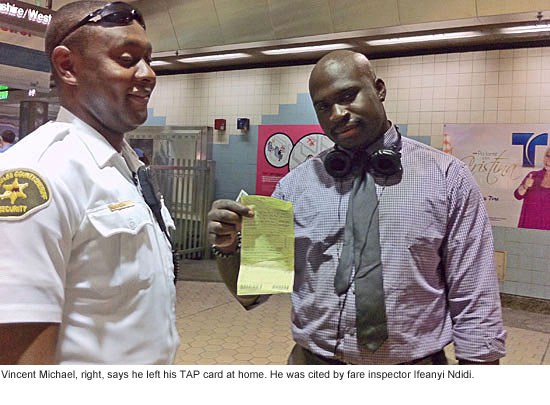 For Conrad Armour, the free ride came to an end Wednesday.
Not that the 23-year-old student was intentionally trying to evade the subway fare; he swears he inadvertently left his monthly pass in his gym locker. But on this particular afternoon, a gym locker was the worst possible place for that pass to be.
Metro officials, preparing for the first time to bring locked turnstile gates to local subway lines, are conducting a pilot test in four stations this month. That means spot-checking passengers’ tickets as they get off trains and monitoring ticket sales as incoming patrons realize they’ll have to pay to ride, or face the consequences. (A ticket for fare evasion can mean a $250 fine.) The test run is intended to explore, among other things, how many fare evaders the locked gate system could turn into paying customers.
As incredible as it might seem to transit riders from other big cities like New York and San Francisco, where locked gates are the time-honored way to prevent or at least slow down fare-beaters, Los Angeles’ subway was designed to operate on the honor system.
In recent years, Metro has taken steps to change that. In 2008, the agency’s board approved installation of a $46 million barrier gate system for L.A.’s Red Line and Purple Line subways as well as some light rail lines. At the time, it was estimated that fare-beaters cost the system $5.5 million a year, and that the system would begin paying for itself in its fourth full year of operation.
By last year, the turnstile gates were all installed but have remained unlocked while the agency tries to figure out how best to implement the new system. Still-unresolved issues include finding ways to handle passengers with paper tickets instead of the widely-used TAP “smart cards” that are designed to open the gates, and to incorporate travelers from other local transit lines that haven’t become part of the TAP network.
There’s also been debate over how far the amount of additional ticket revenue will actually go toward offsetting the cost of changing the system.
On Wednesday, Metro’s team directed patrons coming into the Purple Line’s Wilshire/Western station based on whether they had a TAP card, a paper ticket or no ticket at all. Vending machines appeared to do a brisk business selling to customers who may or may not have been planning to pay.
“It’s a lot more than a handful,” observed Supervisor Zev Yaroslavsky, who dropped by the station Wednesday as part of a small delegation of Metro board members including Santa Monica Councilmember Pam O’Connor, Lakewood Vice Mayor Diane DuBois and representatives from the office of Los Angeles Mayor Antonio Villaraigosa.
As part of the operation, fare enforcement officers were on hand to spot-check for tickets as passengers got off the trains.
While many people showed legitimate tickets or cards, many others did not. And the excuses were flying.
“The stories—some of them are good,” said Daniel Pickering, who along with Ifeanyi Ndidi was checking to make sure people had paid their fares.
Pickering said the body language could be a tip-off, with some patrons putting on an elaborate show of patting down their pockets, avoiding eye contact or rushing by flashing just the back of a ticket.
Some passengers—with and without tickets—got flustered.
“Where is that ******* ticket I got for $5?” one woman said as she angrily rummaged through her things before finally producing a ticket and hurrying on her way.
Another was escorted out of the station in handcuffs after a loud and lengthy exchange that escalated after she refused to sign her citation for fare evasion. (A sheriff’s patrol car was summoned but the woman was released after she finally decided to sign.)
The fare inspectors had the discretion to issue a warning or a citation. For example, a visiting student from France, Nathalie Karouni, was given the chance to purchase a ticket instead of getting a citation. And Isaac Taez, an 18-year-old student at the Friedman Occupational Center, got off with a warning.
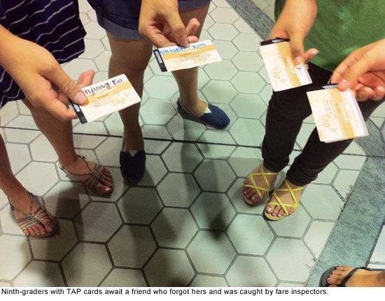
Other travelers were slowed down a bit, like the 9th grade girls who had to wait for the one member of their group who’d forgotten her TAP card Wednesday and had to explain herself to the fare inspectors.
Sgt. Jeff Jablonsky, the sheriff’s department’s liaison to the TAP card/gating program, said 53 citations have been given out during the test program so far, with more likely next Wednesday, October 19, when all four of the test stations will be operating with locked gates from 1 p.m. to 4 p.m. (The stations are Wilshire/Normandie and Wilshire/Western on the Purple Line, and Vermont/Beverly and Hollywood/Western on the Red Line.)
In addition, he said, 5 people have been arrested, including a suspected graffiti vandal and a suspect with an outstanding warrant for a narcotics violation.
Jablonsky said that from what he’s heard, the transit-riding public supports locking the gates. “The comment that we’ve heard most of the time is, ‘It’s about time,’ ” Jablonsky said. “And we have other ones who say ‘I’m from New York and our gates are locked all the time. I don’t understand why your gates aren’t locked.’ The public is ready for it.”
That seemed to be the prevailing sentiment among travelers Wednesday. “I use the train, so I should pay for it. Otherwise I should walk,” said Sacha Larrabee, a 33-year-old grad student at Azusa Pacific University.
“It’s better because usually people come down here with nothing—no money, no TAP card,” said Alex Avalos, 18. “It’s like it’s free!” agreed Alyssa Segarra, 19.
Even some of those cited seemed more resigned than angry.
“I have a bus pass!” said Armour, the student who said he’d left the pass in his gym locker. “Unfortunately I just got caught up in it.” He said he was confident he could convince a judge to throw out the ticket when he produces the pass.
Vincent Michael, a 22-year-old security officer, said he also plans to fight his citation.
“I have a TAP card, a valid one, and I forgot it at home today, so I’ll just take it to court,” he said, before offering his support for the locked-gate project.
“It keeps everybody on their toes,” he said. “It makes everybody pay the fare.”
Posted 10/13/11
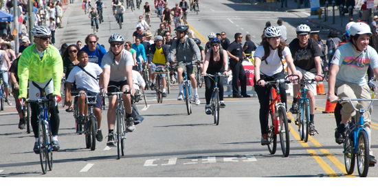
A big wheel in L.A.’s bike world
October 5, 2011

If there’s a geographic birthplace for Los Angeles’ burgeoning bicycle culture, it’s Eco-Village, the cooperative living compound tucked away on an East Hollywood side street and home to many of the activists who over the past 15 years have sparked an improbable cycling revolution in this most car-loving of cities.
And if you’re looking for someone who was there for the birth and has remained a leading voice through the movement’s sometimes challenging adolescent years, meet Joe Linton, the affable, versatile and endlessly energetic community organizer—and longtime Eco-Villager—who’s on a mission to humanize L.A.’s streets, one lane, path and policy at a time.
Linton, along with a handful of other bicycle pioneers, has played a seminal role in Los Angeles’ ongoing transportation transformation—with the most visible and exuberant public manifestation of their years of work coming this Sunday, October 9, in the form of CicLAvia, in which 10 miles of city streets will go car-free for a freewheeling street festival/bike excursion/urban explorathon that’s expected to draw 100,000 participants.
Sunday’s CicLAvia, the third in what Linton and others hope will eventually become a far more frequent facet of Los Angeles street life, runs from 10 a.m. to 3 p.m. on a route that stretches from Hel-Mel (the Heliotrope Drive and Melrose Avenue neighborhood that’s home to the community-christened Bicycle District) to Hollenbeck Park in East L.A. New spurs will extend the route north for the first time to El Pueblo de Los Angeles and south as far as the African American Firefighter Museum. (A route map and directions are here. Information on getting there via Metro—and navigating all the bus detours—is here.)
 And Linton will be, as he has for so many of L.A.’s big moments in cycling, right in the thick of it. As a fulltime consultant to the event, he’ll be helping to deploy an army of some 400 CicLAvia volunteers (and he’s still on the lookout for more. Click here to sign up.) He’ll probably also jump in to serve as a “route angel,” assisting with simple bike repairs along the way. And leading up the event, he’s been blogging about what’s in store, from street chess to dodge ball to Balinese gamelan music, along with colorful overviews of what the new route will offer to the south and north.
Linton’s CicLAvia portfolio, mingling big picture vision and in-the-trenches hard work, reflects his multifaceted approach to activism. Not only did he co-found the Los Angeles County Bicycle Coalition—the influential bike advocacy organization that helped shape the city’s recently-adopted Bike Plan—he also designed the organization’s first T-shirt. In addition, he’s worked for C.I.C.L.E., another prominent L.A. bike group.
Linton doesn’t look like a stereotypical cycling fanatic. On a recent morning in Eco-Village and the nearby Bicycle District, he wears the local equivalent of business casual—black polo shirt and khakis (although it must be noted that in his case the khakis are shorts.) He smiles often as he runs into fellow activists, and is candid about how far L.A.’s cycling movement has come—and how far it still has to travel.
“Some weeks I feel like we’re finally changing,” he says, “and some weeks I feel like ‘Oh man, they’re up to the same old tricks that they said they wouldn’t do.’ ”
Overall, he seems to be a glass-half-full kind of guy. A vigilant monitor of how government agencies follow through on their commitments—he’s watching the progress of the city’s bike plan closely—he also sees the importance of selling his fellow Angelenos on the notion that making streets friendlier for cyclists will improve everyone’s quality of life.
Thus, no car-hating here: “I don’t think we need to fight against cars. I think we need to promote fun, wonderful alternatives and the cars will gradually fade away. We’ll still use them for things that we really need them for but I think they’ll be less and less in demand.”
He shrugs off being called a “founding father” of the movement—“I think I am just one of many folks who are working hard on this”—but it’s hard to find anyone who’s contributed more, or longer.
So how’d a fellow from suburban Orange County end up helping to rewrite the rules of the road in one of the largest and most vehicle-entrenched cities on earth?
Well, like the best bike paths, Linton’s route has had some interesting curves in it.
Linton, now 48, grew up in Tustin and remembers riding his bike all over, including to the ocean by way of the Santa Ana River Trail. A visual artist and author as well as a cyclist, he studied biochemistry at Occidental College but “got politicized” and left the pre-med track. He lived and worked for a time in Long Beach, ditched his car, moved to L.A. and got a job as a systems analyst at Children’s Hospital. At the same time, he plunged into the world of activism, notably on behalf of Friends of the L.A. River.
By 1996, he was living at Eco-Village, where the Bicycle Kitchen, the non-profit bike repair organization that would also become a major player in L.A.’s cycling evolution, was born in the compound’s actual kitchen. Before long, he was a fulltime activist.
Talk about being in the right place at the right time.

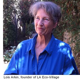
“We like to consider LA Eco-Village as the center of bicycle culture in L.A.,” says Lois Arkin, Eco-Village’s founder, who on a recent morning was strolling along a shady back path at the compound, a basket of just-harvested guavas on her arm. “It all emanated from here. This is where it all started.”
You can see why. With its backyard composting, potluck dinners, bicycle room, solar dryer (read: clothes line) and egg-laying hens, Eco-Village is a full-on green living demonstration incongruously come to life right behind a bustling Vermont Avenue strip mall complete with Little Caesars and KFC. The buildings will soon be owned by a residents’ cooperative and the land held by a community trust, to ensure that the same mix of very-low-to-middle-income residents can always live there, Arkin says.
It’s the kind of place that gives a $20-a-month rent discount to residents who don’t own a car. Where else would L.A.’s bicycle revolution begin? Arkin credits Linton and other residents such as Ron Milam, who with Linton co-founded the bicycle coalition, and Bobby Gadda, who helped import the CicLAvia concept from Bogotá and now serves as its board president (as well as one of Eco-Village’s resident beekeepers.)
There’s a lot riding on their efforts—and on CicLAvia, Arkin says: “The big goal for Angelenos is for us to overcome our stereotype and our stereotype is that we’re car-centric. We simply need to transcend our stereotype. That may give the whole world hope and more optimism.”
Nearby, the Bicycle District stands as an example of transcended stereotypes. As traffic buzzes by on Melrose, this stretch of Heliotrope is buzzing in its own way. Bicycles and a few cars line a walkable block that’s home to an organic coffeehouse, hip eyeglass boutique and Scoops ice cream shop, as well as the Orange 20 Bikes store and the nonprofit Bicycle Kitchen, which has relocated from Eco-Village’s kitchen to its own storefront. (The original kitchen’s now a food co-op.)
“I always describe this as our slice of Portland,” says Matt Ruscigno, a public health consultant specializing in vegan nutrition. “This is phenomenal. I mean, look at all these bikes.”
And everybody, it seems, knows Linton.
“A lot of bike energy is concentrated here,” Linton says. “It’s way cooler today than it was in the ‘90s.”
As if to prove his point, up rolls Kelly Martin, “operations facilitator” at the Bicycle Kitchen. As she takes off her bicycle helmet and opens the door, she and Linton reflect on CicLAvia’s bigger meaning.
“What CicLAvia does is it slows L.A. down to the pace of a cyclist or a walker,” Martin says.
“It’s a democratization of public space,” Linton agrees. “If you take the cars away, it becomes a really egalitarian space.”
On this morning, less than a week before CicLAvia, he’s pushing a simple message: “I think a healthy city gives people options. You should have choices for trips, and you use the one that works for you.” (In this part of town, though, it’s clear that going without a car is a badge of honor, with people exchanging their number of car-free years as easily as their phone numbers. Linton’s number is 20. He bikes just about everywhere, although he travels by foot and public transit a fair amount, too.)
Nearby, Ron Milam, Linton’s bicycle coalition co-founder who now has his own consulting practice, sits at one of Cafecito Organico’s sidewalk tables. He takes a few minutes to reminisce about the early days, and victories like bike lanes on Silver Lake and Venice boulevards, and getting Metro to increase its funding for cycling and pedestrian projects.
“Of anybody, Joe put the most time and energy into it,” Milam says, recalling that while others debated whether a bike coalition was needed in L.A. County, “Joe said, ‘Absolutely, let’s do this!’ ”
When that can-do spirit hits the streets Sunday, CicLAvia participants are likely to experience something fresh, whether they traverse the route on two wheels, or two feet.
“Cyclists and pedestrians can share spaces,” Linton says. “They do it all over the world; they do it all over L.A. That’s what makes cities great. We all need to enter the mix and be respectful.”

Posted 10/5/11
A star is worn (but help’s on the way)
August 10, 2011

Groucho Marx is cracking up. Burt Lancaster looks ready for some rehab. And as for Kermit the Frog—well, let’s just say his current situation is something you wouldn’t wish on a reptile.
We’re talking, of course, about stars on the Hollywood Walk of Fame, where years of damage and deterioration have taken a heavy toll. Now, some of the Walk’s most visible stars are ready for their touch-up.
Metro’s Board of Directors recently voted to spend $1.5 million to fix up the stars and their surroundings outside the Hollywood/Highland Red Line station as part of a cost-sharing agreement with the Hollywood Historic Trust, which will carry out the work. Other funding for the $4.1 million project is coming from the City of Los Angeles’ Community Redevelopment Agency, the Hollywood Chamber of Commerce, the Hollywood Historic Trust and private donors.
“The Walk of Fame…has been showing its age for some time,” according to a report to Metro’s Executive Management and Audit Committee. “Over the past 50 years, the condition of the sidewalks has become unsightly and potentially dangerous.”
A major focus of the work will be the north side of Hollywood Boulevard between Highland Avenue and Orange Drive.
The fix-up operation, expected to begin this fall, comes after research into how best to resolve long-standing problems along the famed pink-and-black terrazzo Walk. The review included assigning a letter grade to the condition of each of the Walk’s nearly 2,400 stars—from A to F. The Los Angeles City Council earlier this year adopted new specifications on how the work should be conducted.
Among the 180 star panels likely to be restored or replaced are those honoring Groucho, Burt Lancaster and Kermit (all of which were graded “C”) along with stars in even worse shape (“D” or “F”) paying homage to Peter Frampton, Jackie Chan, Tony Curtis and Harriet Nelson.
“The overall condition of the Walk along this portion is in poor condition. There are multiple areas where the terrazzo layer is completely missing,” the Metro report said.
The work will focus not just on replacing the stars themselves but also on shoring up or replacing damaged sidewalks, curb ramps and driveways.
People walking to and from the Hollywood and Highland Red Line station should expect some pedestrian detours once the work gets underway; it’s expected to take from three to five months.
More than 10 million people a year visit the Walk, which runs along Hollywood Boulevard from Gower Street to La Brea Avenue and on Vine Street from Yucca Street to Sunset Boulevard. Their numbers are likely to increase now that a new Cirque du Soleil production has taken up residence at the Kodak Theater, the Metro report said.
Previous repairs on the Walk of Fame near Hollywood and Vine were funded by the developer of the W Hotel Hollywood, which opened earlier this year. And individual star panels and areas of the Walk have been repaired one by one over the years, said Jeffrey C. Briggs, a Hollywood Historic Trust board member who also serves as the organization’s legal counsel.
But the upcoming renovation will be the first large-scale effort since the new city guidelines were enacted.
“Metro’s contribution is extremely important and is critical to the overall long-term maintenance of the Walk of Fame, which is the No. 1 tourist destination in Southern California,” Briggs said.
Posted 8-9-11
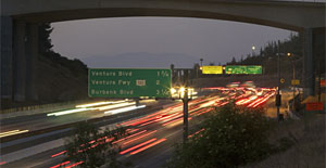
53 ways to survive without the 405
July 13, 2011
Editor’s note: These tips from the original Carmageddon could still be useful this time around. The dates have changed, of course; the 405 closure is Sept. 29-30.
In case you haven’t heard, official Los Angeles wants you to get out of town the weekend of July 15-18, or to make it a stay-close-to-home time as demolition of the Mulholland Bridge shuts down the 405 Freeway. For those of you planning to tough it out here in L.A., we asked some of our county colleagues to help us compile tips for turning 53 hours of Carmageddon fever into some good communal karma. Here’s what we came up with:
Hunkering down
1. Honor the demise of the Mulholland Bridge by holding a mini-film festival of movies from 1960, the year it was completed. Some classic options include “Psycho” and “Spartacus.” Or see how far you can get, screening your way through AFI’s list of America’s 100 Greatest Movies.
2. Continue the mid-century theme by making a playlist that includes 1960 hits such as “It’s Now or Never” and “Only the Lonely.”
3. Adopt a pet from a local animal shelter, and spend the weekend introducing your newest family member to your home and neighborhood. Locate a nearby L.A. County shelter here; call ahead to find out whether they have animals ready for same-day adoption.
4. Dust off some old board games and hold a Clue, Scrabble or backgammon marathon. At least that little Monopoly car will still be able to zip around the board, even if the rest of Southern California is stuck in a weekend-long Sigalert.
5. Plan your next vacation(s).
6. While away a few hours perusing the Los Angeles Public Library’s digital collections of old movie posters, travel posters, fruit crate labels and photographs. (Just type in a keyword such as “Hollywood” and a year span of, say, 1959-1960, and start feasting your eyes on some amazing shots.)
7. Join Los Angeles Times architecture critic Christopher Hawthorne in his yearlong “Reading L.A.” project. The July titles include “The History of Forgetting: Los Angeles and the Erasure of Memory” and “Holy Land: A Suburban Memoir.”
8. Get an early jump on your holiday shopping without getting out of your pajamas by patronizing some of these L.A. County online stores.
9. Get organized, and do some good at the same time: Clean out your pantry and donate non-expired canned goods to a food bank. Go through closets for items to give to a charitable thrift shop. Gather up loose change and earmark the proceeds for a cause you care about.
10. Take this quiz and see if your kitchen could earn an “A” from county public health inspectors.
11. Make sure you have emergency kits in your car and at home. Check out the Department of Public Health’s emergency preparedness site for its list of 10 essential items. Update your family emergency preparedness plan and practice it. And while you’re at it, check out the county Fire Department’s fire prevention resources, too.
Building community

12. If you have a pool, invite your neighbors over for a swim and an outdoor movie.
13. Go door-to-door and collect neighbors’ phone numbers and email contacts for an emergency phone tree.
14. Organize a block party.
15. Buy a large canvas and set it on an easel in front of your house along with paints, brushes and a sign asking passersby to get artistic.
16. Enlist your neighbors in a community walking group.
17. Start a Neighborhood Watch group.
18. Drop by your local fire, police or sheriff’s station and say hello.
19. Take an interest in where your neighborhood lands in the county’s redistricting process by weighing in here. The Board of Supervisors is expected to adopt a redistricting plan by August, 2011.
20. Make a list of 10 people you haven’t spoken to in a long time and call them to say hello. Better yet, surprise each of them with a handwritten letter.
21. Check in on a sick or elderly neighbor and offer your services in the yard, kitchen or laundry room, or as an errand-runner for the afternoon. A ride to religious services might be appreciated, too.
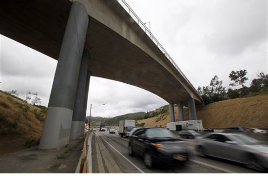
22. Form a neighborhood group to ride in the new northbound 405 carpool lane that will stretch from the 10 to the 101 when the Sepulveda Pass project wraps up in 2013…and share the gain that comes after the pain.
Out and about

23. Be the first on your block to experience the Natural History Museum’s spectacular new Dinosaur Hall, which opens July 16. Public transportation options are probably best; find them here.
24. Frolic in a local park. Los Angeles County has more than 150 of them, so pack your Frisbee and a picnic and enjoy the summertime weather with your family. More information about park locations and amenities is here.
25. Get a library card. Or, if you already have one, make it a point to drop by over the weekend and learn about opportunities for volunteering or donating.
26. Get a group together for a Metrolink daytrip. San Juan Capistrano, anyone? Check out the station map here for other possible destinations.
27. Plug your address into www.walkscore.com and find out how walkable your neighborhood is. Then start hoofing it.
28. Patronize locally-owned businesses. (Many will show up, along with other amenities such as parks, on Walk Score, above.)
29. Take a hike. Trail systems in Los Angeles range from easy strolls to challenging hillsides. Find one that’s close to you.
30. Hit the links at a county golf course. Skip the cart rental and enjoy the walk.
31. Stock up on healthy fruits and vegetables at your local farmers market.
32. Grab your camera and head out in search of your neighborhood’s most distinctive features, from lampposts and architecture to flowerbeds and wildlife. Share your photos on Supervisor Yaroslavsky’s website.
33. Whether your taste in entertainment runs more to “Shrek The Musical” at the Pantages or Sarah McLachlan at the Hollywood Bowl or “Les Misérables” at the Ahmanson, there’s a way to get there by public transportation. And this is just the weekend to give it a try.
Make it a green weekend

34. Tear out your lawn and replace it with native plants.
35. Plant a tree. Or outsource the work to TreePeople, in honor of someone you love.
36. Start a garden. The benefits—fresh air, exercise—will go well beyond the tasty vegetables and herbs you’ll harvest. Tips are here.
37. If you’ve already got a garden, host a garden party (fancy hats optional) and send everybody home with a cutting.
38. Organize or join a produce-sharing cooperative on your block…and start off by pooling backyard lemons and making a giant batch of lemonade for everyone to share.
39. Start a backyard compost pile. (Read up first on all the benefits here.)
40. Get in line for some green by signing up your house for Energy Upgrade California at www.lacountyenergyprogram.org
41. Calculate your home’s solar energy potential.
42. Grab your reusable shopping bags and flaunt them everywhere you shop in honor of the county’s new plastic bag ban.
43. If you live near the beach, or can get there on the bus, take to the sand and help clean it up. For a list of more organized clean-up activities, look here.
44. Find out how and where to get rid of used motor oil or old computers and other “e-waste.”
45. Install some eco- and design-friendly rainbarrels to store rainwater from your roof for future use. (More information starts on Page 27 of this county manual.)
Go car-free for a day—or forever
46. Ride the subway for free all weekend long. Update: There are no free rides for Carmageddon II.
47. Explore a wealth of summer destinations on public transportation.
48. While you’re riding, check out the art. Or really save energy and check out Metro’s art virtually.
49. Go out to eat without guzzling gas. The possibilities range from pastrami to rice porridge on Metro’s Dining Map.
50. Help plan and promote the next car-free CicLAvia.
51. Look up the bike trail that’s nearest to your house, and give it a try. Detailed path maps are here.
52. Get a pedestrian’s eye view of L.A. history by following one of these self-guided Angel’s Walk itineraries. Other downtown walks are here.
53. Practice riding your bike to work …and then when Monday rolls around, really do it. And congratulations, you made it through 53 hours without the 405 Freeway!
Posted 6/15/11


 405 bridge work causes a stink